Garmin GPSMAP 65 Handhel GPS (010-02451-00) – KBM Outdoors
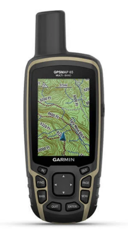
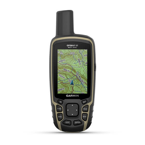
FIND YOUR WAY IN THIS BIG, WIDE WORLD Explore more with this rugged handheld that offers multiple frequencies for our most accurate position to date, a 2.6” color display and preloaded maps. Don’t miss a detail with this large, sunlight-readable color display. Lead the way in challenging locations with multi-band techn
FIND YOUR WAY IN THIS BIG, WIDE WORLD
Explore more with this rugged handheld that offers multiple frequencies for our most accurate position to date, a 2.6” color display and preloaded maps.
Don’t miss a detail with this large, sunlight-readable color display.
Lead the way in challenging locations with multi-band technology and expanded GNSS satellite support.
Cross the countryside with routable TopoActive maps for the U.S. and Canada.
Venture confidently. This rugged handheld is built for tough environments.
Organize your adventure from anywhere with the Garmin Explore™ website and app1.
Travel with up to 16 hours of battery life in GPS mode.
Follow your path.
EXPANDED GNSS SUPPORT
Multi-band technology and expanded GNSS support (GPS, GLONASS, Galileo, QZSS and IRNSS) provide optimal accuracy in steep country, urban canyons and forests with dense trees.
PRELOADED TOPO MAPS
Preloaded TopoActive U.S. and Canada maps show you terrain contours, topographic elevations, summits, parks, coastlines, rivers, lakes and geographical points.
PUBLIC LAND BOUNDARIES
An optional display of federal public land boundaries on topographical maps helps you know that you’re venturing where you’re supposed to be.
SMART NOTIFICATIONS
Receive emails, texts and alerts right on your handheld when paired with your compatible device.
GARMIN EXPLORE APP
Plan, review and sync waypoints, routes and tracks by using the Garmin Explore app1 and website. You can even review completed activities while still in the field.
MICROSD™ SLOT
Using your compatible device and microSD memory card, conveniently download TOPO 24K maps and hit the trail, or access HuntView Plus maps to see public land types and boundaries as well as private landowner names and boundaries.
GEOCACHING
Get paperless geocaches by uploading GPX files straight to your device. View key information such as location, terrain and hints from Geocaching.com.
General
PHYSICAL DIMENSIONS
2.4 x 6.3 x 1.4 (6.1 x 16.0 x 3.6 cm)
DISPLAY SIZE
1.43 x 2.15 (3.6 x 5.5 cm); 2.6 diag (6.6 cm)
DISPLAY RESOLUTION
160 x 240 pixels
DISPLAY TYPE
transflective, 65K color TFT
WEIGHT
7.7 oz (217 g) with batteries
BATTERY TYPE
2 AA batteries (not included); NiMH or Lithium recommended
BATTERY LIFE
16 hours
WATER RATING
IPX7
HIGH-SENSITIVITY RECEIVER
INTERFACE
high speed mini USB and NMEA 0183 compatible
MEMORY/HISTORY
16 GB (user space varies based on included mapping)
Maps & Memory
PRELOADED MAPS
yes (TopoActive; routable)
ABILITY TO ADD MAPS
BASEMAP
AUTOMATIC ROUTING (TURN BY TURN ROUTING ON ROADS)
MAP SEGMENTS
3000
BIRDSEYE
250 BirdsEye Imagery files
INCLUDES DETAILED HYDROGRAPHIC FEATURES (COASTLINES, LAKE/RIVER SHORELINES, WETLANDS AND PERENNIAL AND SEASONAL STREAMS)
INCLUDES SEARCHABLE POINTS OF INTERESTS (PARKS, CAMPGROUNDS, SCENIC LOOKOUTS AND PICNIC SITES)
DISPLAYS NATIONAL, STATE AND LOCAL PARKS, FORESTS, AND WILDERNESS AREAS
EXTERNAL MEMORY STORAGE
yes (32 GB max microSD™ card)
WAYPOINTS/FAVORITES/LOCATIONS
5000
TRACKS
200
TRACK LOG
10000 points, 200 saved tracks
ROUTES
200, 250 points per route; 50 points auto routing
Sensors
GPS
GLONASS
GALILEO
QZSS
IRNSS
GPS COMPASS (WHILE MOVING)
Daily Smart Features
VIRB® REMOTE
PAIRS WITH GARMIN CONNECT™ MOBILE
SMART NOTIFICATIONS ON HANDHELD
Outdoor Recreation
POINT-TO-POINT NAVIGATION
COMPATIBLE WITH BASECAMP™
AREA CALCULATION
HUNT/FISH CALENDAR
SUN AND MOON INFORMATION
GEOCACHING-FRIENDLY
Yes (Paperless)
CUSTOM MAPS COMPATIBLE
yes (500 custom map tiles)
PICTURE VIEWER
Outdoor Applications
COMPATIBLE WITH GARMIN EXPLORE™ APP
GARMIN EXPLORE WEBSITE COMPATIBLE
Connections
WIRELESS CONNECTIVITY
yes (BLUETOOTH®, ANT+®)
Garmin GPSMAP® 65 Handheld Outdoor GPS

Garmin GPSMAP 65 Series (65 or 65s), Button-Operated Handheld with Inc – Sports and Gadgets

Garmin 010-02451-10 GPSMAP 65s Multi-Band/Multi-GNSS Handheld with Sensors Bundle with 1 YR CPS Enhanced Protection Pack : Electronics
Garmin GPSMAP® 66sr (010-02431-00) – KBM Outdoors

Garmin GPSMAP 65, Button-Operated Handheld with Expanded Satellite Support and Multi-Band Technology, 2.6 Color Display, 010-02451-00 : Electronics

Garmin GPSMAP 65, Button-Operated Handheld with Expanded Satellite Support and Multi-Band Technology, 2.6 Color Display, 010-02451-00 : Electronics

Garmin Varia RTL515 (010-02376-00) – KBM Outdoors

Garmin GPSMAP 65 Handhel GPS (010-02451-00) – KBM Outdoors
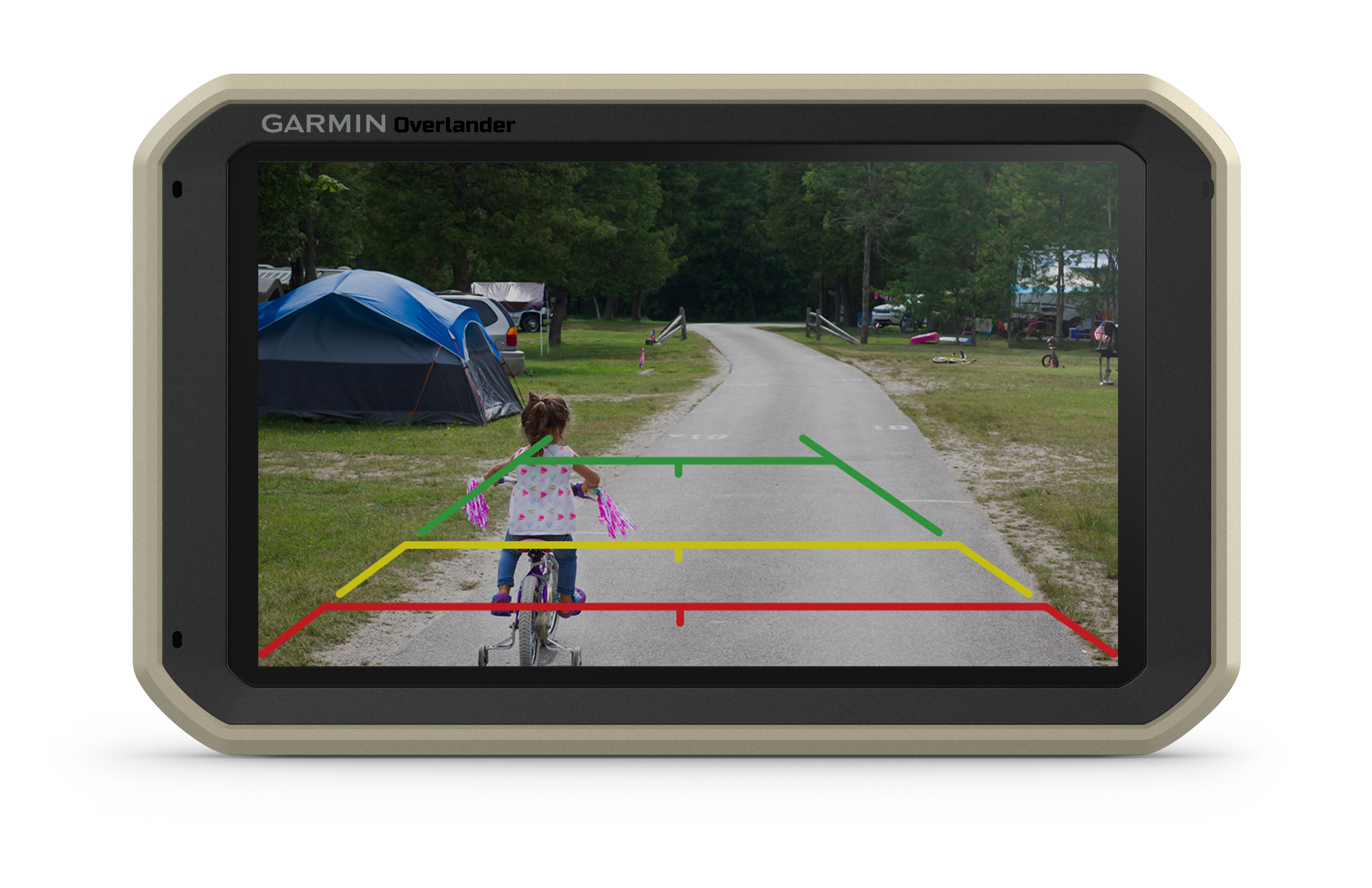
Garmin Overlander MRP (010-02195-00) – KBM Outdoors
Garmin – Page 2 – KBM Outdoors